Snowline Mountain Sim
The problem I've been trying to solve ever since I started Snowline was how do you represent a ski resort visually. Whether it is how big it is? How many lifts there are? Is it for beginners? Can you go off piste?
Snowline started with the official course maps, webcams and ski resort data on OSM-based maps.
I want to get to is being able to feel the mountain, see how the terrain looks like rather than trying to interpret this from contour maps or hill-shading. The Mountain Diorama that I introduced was final shippable realisation of this, a 3D map you can not only see the terrain, but see the trees, the moving lifts and even people riding down. This is a throwback to one of my favorite games, Sim City 2000 where you can see animated cards and moving wind turbines.
The ultimate map would be one that you can use to feel the resort. Look at the terrain as though you are there. The same way you can do this in Google's Street View and Driving Mode. We have all the data to build the diorama, so what happens if you change the view and make a snowboarding avatar you navigate inside the diorama?
This is Snowline Sim, a full on simulation of the runs in a ski area:
Snowline Sim works in several places around Snowline.
There's a dedicated Snowline Sim page that lets you quickly look up a resort and jump straight into it. It works for Japanese and international resorts. It is the main way you can use this with non-Japanese resorts since Snowline so far has focused on Japanese resorts.
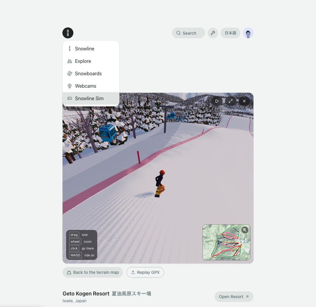
For Japanese ski areas, these show up on the current Snowline location pages for example, Nozawa Onsen, Hakuba Happo-One, Niseko United, Rusutsu and more. It's just right there at the top of the page so you're not just reading about the resort, you can jump straight in.
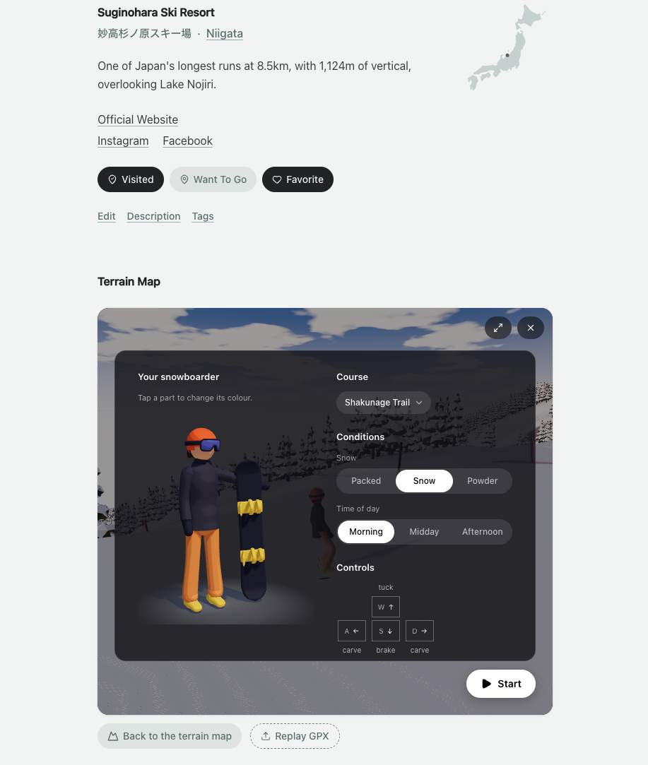
If you have uploaded GPX sessions on your Snowline profile, you can also start the Snowline Sim straight from the uploaded session in your profile and relive your tracks.
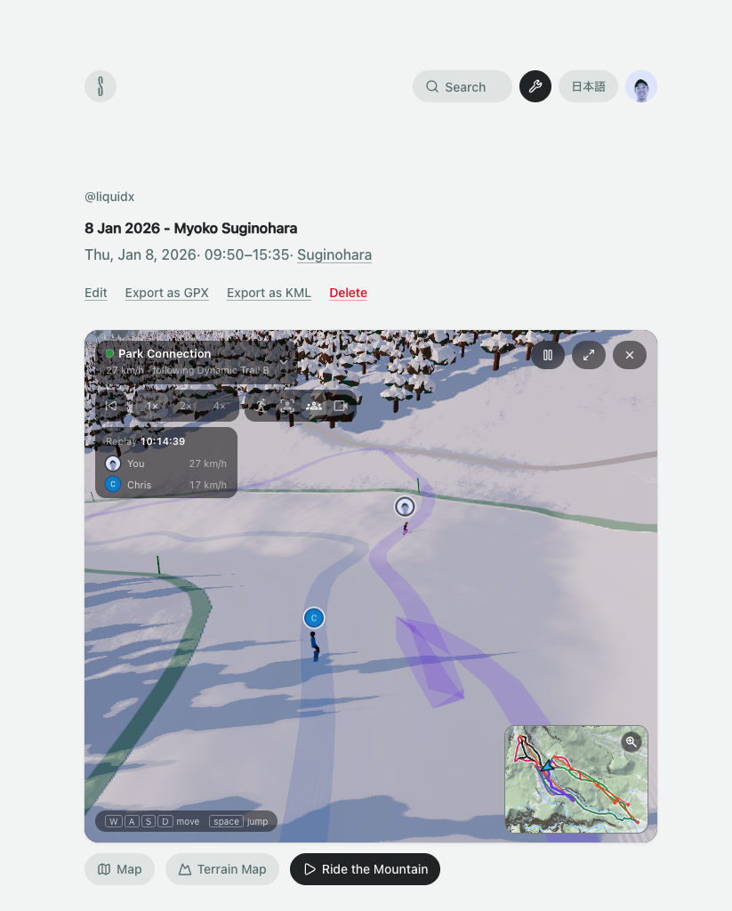
Once you're in the Sim, you start riding around straight away. For now you only get to Snowboard. It'll drop you on to the top of the mountain but you're able to teleport anywhere around the resort, through the mini map or pausing and clicking around.
If you have been tracking your days at the resort with apps such as Slopes, you can export the GPX (or Slopes) file from it and import it into the Sim.
Snowline require you to create an account and sign in to do this because we want to be able to process the data and use it to draw the map.
With the GPX traces, you can replay the runs in the Snowline Sim, or just have it drawn on the map where you can follow with your little snowboarder.
If you did a run multiple times, it even lets you show all those runs together in one single replay.
Finally, if you have other friends who you rode with, if they also use Snowline and upload their GPX files, and you can replay runs that you did together!
No proper sim is complete without the ability to customize your look. So in the menu you can select your look from your helmet all the way down to the board and bindings.
Snowline is focused on Japanese ski areas, and so this works best with Japanese locations. The terrain data is highly detailed from GSI Japan at 1m or 5m resolution.
But there's no reason why we can't do this for resorts in other countries. So through the Snowline Sim page, you can search for non-Japanese resorts and try it out. Big caveat is that some European and American resorts are 5x larger than the largest ones in Japan, so some of these will choke and even crash your browser.